|
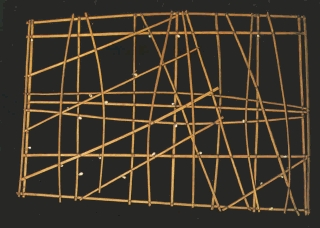
The above map shows a roughly 500-mile area around the Marshall Islands in the Pacific. The outer frame represents the sea, interior curved twigs the
prevailing wave-fronts. The shells, attached with coconut fibers, stand for islands, and threads let canoe navigators know when they could expect to see the islands appear on the horizon. These charts were portable.
Text by Richard Bright.
|